
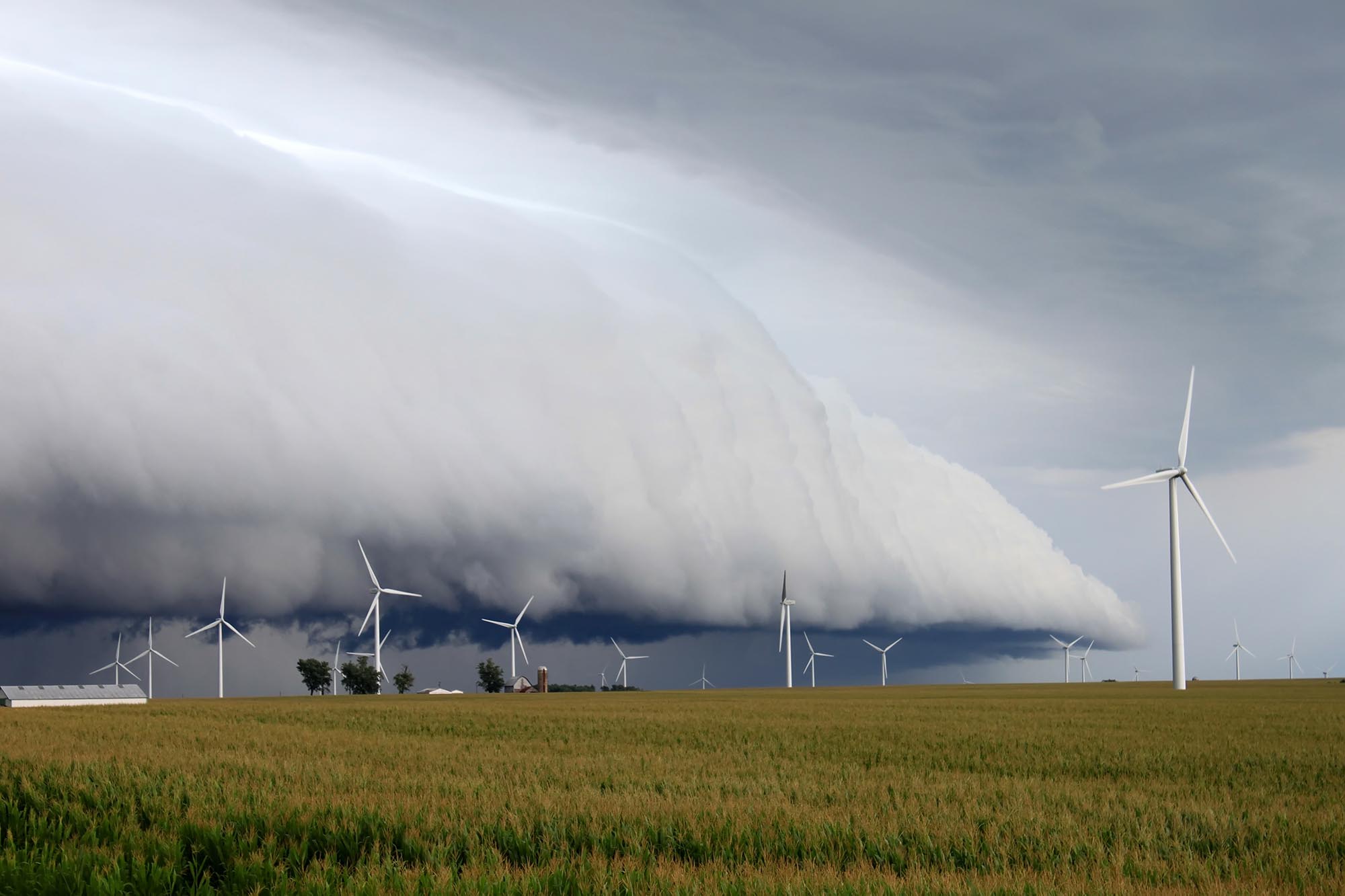
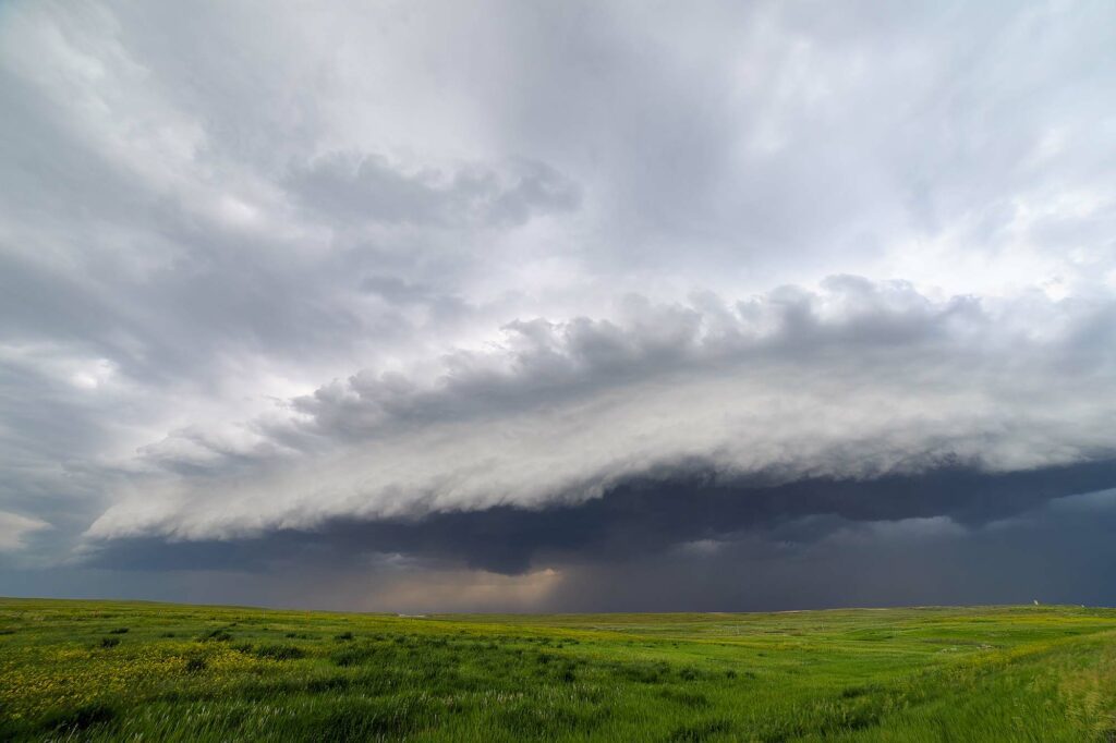
A squall line is a line of strong and severe thunderstorms common in spring and summer and often produce strong winds, lightning, heavy rain, and hail. Squall lines often form ahead of cold fronts but can develop independently if several strong thunderstorms merge.
Squall lines often damage property since they cover such a large area. This blog explains the meteorology behind the phenomenon and what you should do.
What is a squall line?
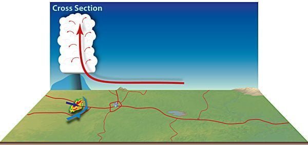
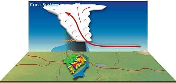
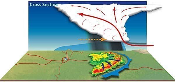
A squall line is a band of thunderstorms, which can be hundreds of miles long. These lines typically form along the leading edge of a strong cold front, where there is a sharp temperature difference ahead and behind the front.
As the two air masses collide, they create an area of instability as the cold air scours out the warm air, creating lift. As the air rises, it cools and condenses, leading to clouds and thunderstorms.
A squall line is easily identifiable by a long stretch of stronger returns on radar, typically colored orange and red on most radar imagery.
Squall lines may also ‘bow out,’ otherwise known as bow echoes. A bow echo is a radar echo that often appears as an arc or bow-shaped feature in the reflectivity image. It is caused by a combination of strong updrafts and wind shear and can result in violent downdrafts, causing wind damage.
The dangers associated with squall lines
As opposed to discrete storms, squall lines most commonly produce heavy rain, hail, and strong winds. Tornadoes are less frequent with a squall line. If they do happen, they’re often weak and short-lived.
The most dangerous aspect of squall lines is their potential to create severe straight-line winds. In the most severe squall lines, gusts can approach 100 mph. These winds can easily damage homes and down trees, and power lines can block roads and disrupt power supplies. In addition, heavy rains can lead to flash flooding, which can quickly turn deadly.
One positive to squall lines is that they’re often short-lived thanks to their quick movement. Often the worst weather is over in minutes, although the cleanup afterward may take days or weeks.
Derechos: Squall lines on steroids
A derecho is a widespread, long-lived windstorm associated with a band of rapidly moving severe thunderstorms identified on radar by a well-defined bow echo. Although they are most common in the Midwest and Great Plains, derechos can occur anywhere in the United States.
Derechos are most common during the summer when warm air from the Gulf of Mexico collides with cooler air from the Rockies, creating the instability in the atmosphere necessary for derechos to form. However, they can also occur in the spring and fall.
Derechos are unusual because they can produce hurricane-force winds over a large area, often exceeding 250 miles. As a result, they can cause widespread damage, particularly to trees and power lines. In addition, derechos may come as part of multiple waves of severe weather.
What to do if you are caught in a squall line
If you’re caught in a squall line, the most important thing to remember is to stay safe. Here are some tips on what to do:
- If possible, seek shelter inside a sturdy building. Shelter inside a brick building if possible, and in interior rooms. Stay away from pole buildings and pavilions.
- Avoid being outside in open areas. If you are outside, try to find a low spot away from trees and power lines. Be alert for rapidly rising water, and protect your head.
- Stay away from windows and doors. Doors may break, and windows can shatter due to strong winds and flying debris.
- If you are driving, stay in your car. Pull off the road and into a parking lot or other open area. Do not attempt to exit the vehicle. Do not park under bridges or overpasses.
- Be alert for flash flooding. If you see water beginning to rise rapidly, seek higher ground.
- Have a way out if need be. Be aware of your surroundings and watch for falling debris. You may need to move to protect yourself. Always protect your head, and use a mattress or pillow to protect the rest of your body.