

An outflow boundary is a meteorological term that refers to the boundary between two air masses created by a thunderstorm’s downdraft. If you’ve ever stood outside during a thunderstorm and felt the cool rush of air preceding a storm, you’ve experienced an outflow boundary.
Outflow boundaries aren’t only responsible for those gusts of wind and can trigger new storms, especially when the outflow boundaries of other storms collide.
What is an outflow boundary?
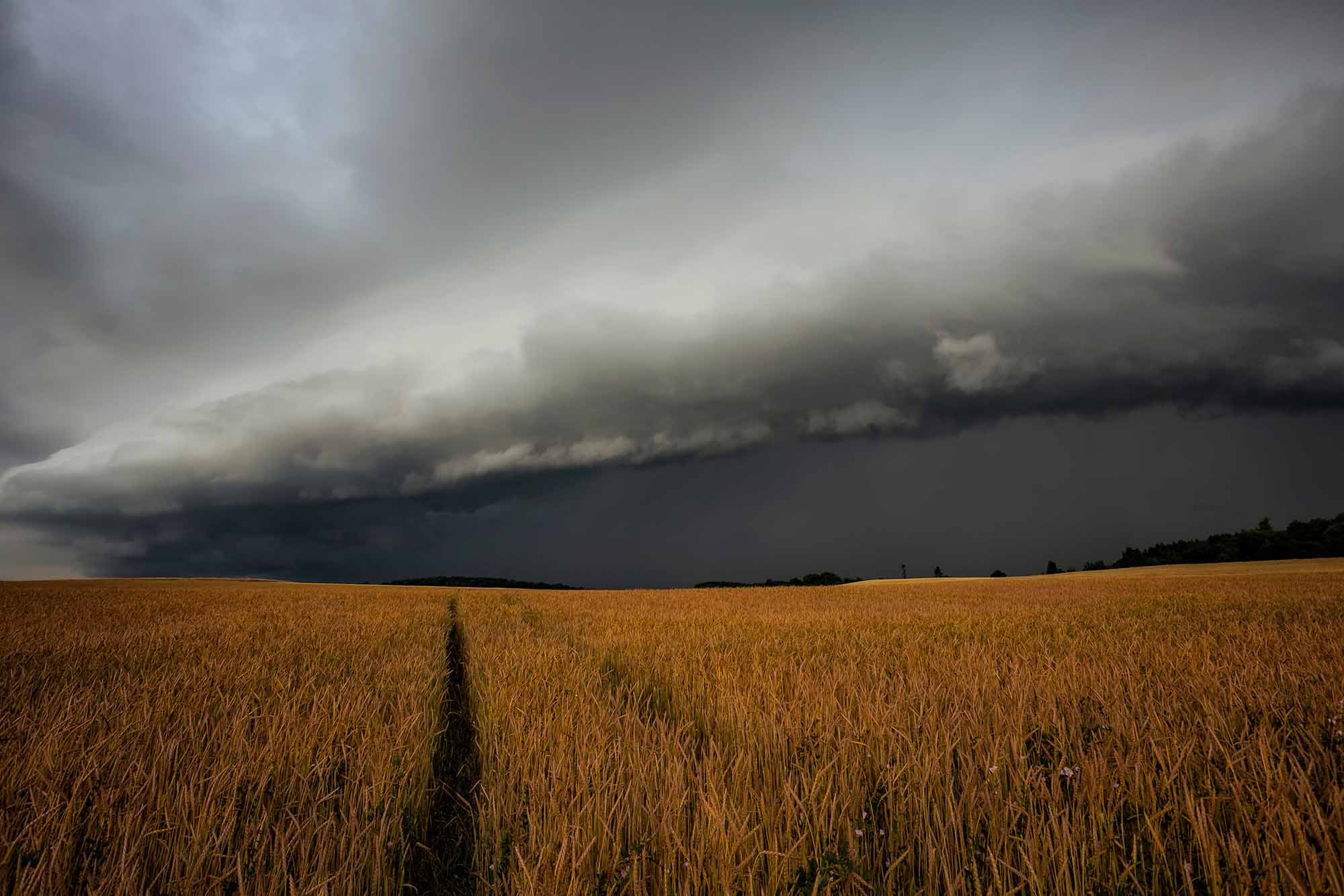
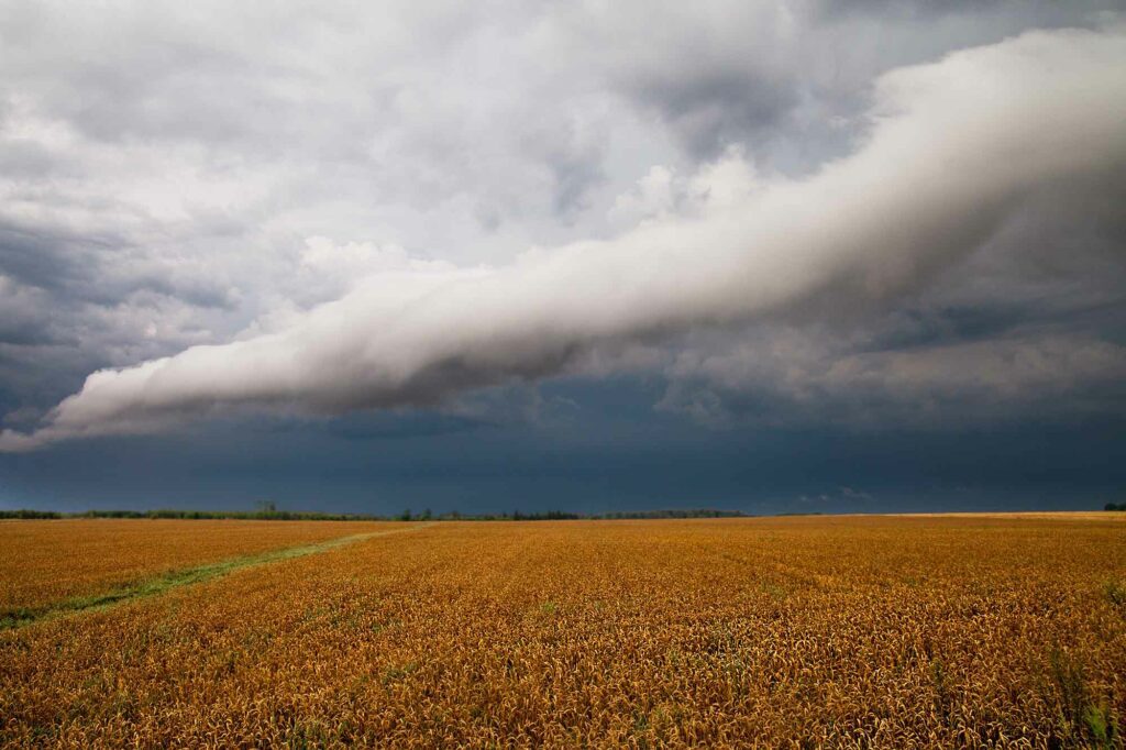
An outflow boundary is a meteorological feature that forms when cold air rushes down and out from the storm (a downdraft), lifting the warm air around it. While this outflow occurs in all directions, the flow will be the strongest in the direction the winds are blowing at the lower levels near the surface.
An outflow boundary is the strongest close to its origin point and dissipates as it expands outward. This does not happen immediately; some boundaries can travel hundreds of miles. They’re often visible on the ground as a shelf or roll clouds and on the radar as a thin line of weak returns. Below we’ve shown an example of an outflow boundary on radar.
How do outflow boundaries form?
Outflow boundaries form when cold air from a thunderstorm downdraft pushes out under the warmer air ahead of the storm. The dense, cold air associated with outflow boundaries can quickly lower temperatures and produce strong winds.
This boundary is sometimes seen as a line of cumulus clouds on the leading edge of a thunderstorm (also called shelf or roll clouds). It is often clearly visible on radar, especially in “velocity” mode, caused by bugs, dust, and other debris blown into the air by the sudden gust of wind at the edge of the outflow boundary.
Outflow boundaries are sometimes associated with cloud and storm development. When these boundaries interact with warm, humid air and one another, they can help to trigger new clouds and storms. On radar, the direction of an outflow boundary can be determined by which way it bows.
If the outflow boundaries of two storms were pointed towards one another on a warm, humid day, a meteorologist would expect a new shower or storm to likely form where these boundaries collide.
Outflow boundaries and severe weather
Outflow boundaries are also called gust fronts, for the sudden gusts, often gusting to 30-50mph. While not necessarily damaging, these winds can easily pick up and throw light objects that aren’t secured to the ground.
In rare cases, the downdraft responsible for the outflow boundary can be extremely strong in what’s known as a microburst. A microburst is a powerful downdraft of air that can produce winds over 100mph. Microbursts are often associated with severe weather, such as tornadoes and thunderstorms. If this happens over a large area, it is called a macroburst. While both are rare events, microbursts are far more frequent.
Over desert areas, outflow boundaries can trigger “haboobs,” dust storms triggered by thunderstorm winds.
Tips for staying safe during severe weather conditions
Severe weather conditions can pose a threat to both life and property. However, there are several steps that you can take to stay safe during severe weather events.
One of the most important things is to stay informed about the latest weather conditions. You can do this by monitoring local news outlets and following the National Weather Service on social media. It is also essential to plan what to do if severe weather strikes. This includes having a designated safe room in your home and knowing the best evacuation route if necessary.
In addition, it is vital to have an emergency kit on hand that includes supplies like food, water, and first-aid supplies. Taking these precautions can help ensure your safety during severe weather events.