

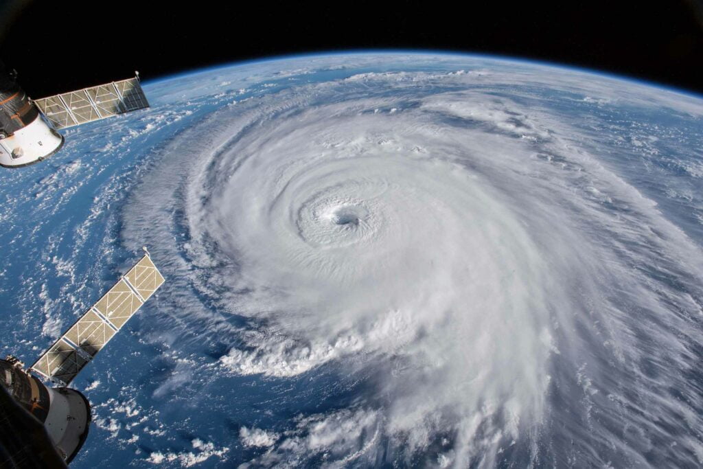
A hurricane local statement is an emergency message that provides critical information about a hurricane. Your local National Weather Service forecast office issues this product, including information about the storm’s location, intensity, and expected impacts.
Do not ignore these warnings. It is essential to read the hurricane local statement carefully. This blog post explains what a hurricane local statement is and how you can prepare for a hurricane.
What is a hurricane local statement, and what does it include?
A hurricane local statement is a National Weather Service message issued for a county or parishes in a Hurricane Watch or Warning. The message includes information about the hurricane, its intensity, forecasted track, and expected impacts.
We’ve included an example of what a hurricane local statement typically looks like below, explaining what each part of the statement means. We used an actual statement issued for Hurricane Laura in 2020 by the National Weather Service office in New Orleans, Louisiana.
This top section contains information on which NWS office issued the hurricane local statement, when it was issued, where it is valid for, and typically a headline summarizing the critical points.
458
WTUS84 KLIX 251532
HLSLIX
LAZ034>037-039-040-046>050-056>072-MSZ068>071-077-080>082-252345-

Hurricane Laura Local Statement Advisory Number 23
National Weather Service New Orleans LA  AL132020
1032 AM CDT Tue Aug 25 2020

This product covers Southeast Louisiana and South Mississippi

...LAURA MOVING ACROSS THE SOUTHEASTERN GULF OF MEXICO...
The next section of the hurricane local statement always includes a section at the top listing any new information since the last statement is issued. This is done to ensure that any warnings, track, or intensity changes aren’t missed. If you’re in a hurry making preparations for the storm, this will give you much of the information you need right away. It will look something like this:
NEW INFORMATION
---------------

* CHANGES TO WATCHES AND WARNINGS:
    - The Tropical Storm Watch has been upgraded to a Tropical Storm
      Warning and the Storm Surge Watch has been cancelled for
      Iberville
    - The Storm Surge Watch has been upgraded to a Storm Surge
      Warning and the Tropical Storm Watch has been upgraded to a
      Tropical Storm Warning for Assumption, Lower Jefferson, Lower
      Lafourche, Lower Plaquemines, Lower Terrebonne, Upper
      Lafourche, and Upper Terrebonne
    - The Tropical Storm Watch has been upgraded to a Tropical Storm
      Warning for Pointe Coupee and West Baton Rouge

* CURRENT WATCHES AND WARNINGS:
    - A Storm Surge Watch is in effect for Hancock, Harrison,
      Livingston, Lower St. Bernard, Orleans, Southern Tangipahoa,
      St. Charles, St. John The Baptist, St. Tammany, Upper
      Jefferson, Upper Plaquemines, and Upper St. Bernard
    - A Tropical Storm Warning is in effect for Iberville, Pointe
      Coupee, and West Baton Rouge
    - A Storm Surge Warning and Tropical Storm Warning are in effect
      for Assumption, Lower Jefferson, Lower Lafourche, Lower
      Plaquemines, Lower Terrebonne, Upper Lafourche, and Upper
      Terrebonne

* STORM INFORMATION:
    - About 480 miles south-southeast of New Orleans LA or about 420
      miles south-southeast of Grand Isle LA
    - 23.7N 87.0W
    - Storm Intensity 75 mph
    - Movement West-northwest or 290 degrees at 16 mph
Next comes an overview of what is currently occurring with the storm and highlights the potential effects on the area covered by the hurricane local statement.
SITUATION OVERVIEW
------------------

Hurricane Laura is currently moving into southeastern portions of
the Gulf of Mexico. This system is expected to strengthen as it
approaches coast of Southwest Louisiana and Upper Texas on Wednesday.
After any new information and an overview of the current situation, most hurricane local statements will go into detail on the following areas:
- Surge: Detailing any potential storm surge or coastal flooding impacts, including expected surge depths, expected damage, and areas most at risk
- Winds: Details impacts and damage expected due to winds due to the tropical system.
- Rain/Flooding: Any impacts due to rain or flooding due to excessive rainfall. If mudslides are a risk, You will find information on those risks here as well.
- Tornadoes: The spin of tropical systems combined with land friction makes tornadoes a risk during landfilling hurricanes. A hurricane local statement will also include information on when and where the risk for tornadoes is the highest.
POTENTIAL IMPACTS
-----------------

* SURGE:
Protect against life-threatening surge having possible significant
impacts across coastal areas of Southeast Louisiana and Southern
Mississippi, mainly west of Ocean Springs. Potential impacts in this
area include:
    - Areas of inundation with storm surge flooding accentuated by
      waves. Damage to several buildings, mainly near the coast.
    - Sections of near-shore escape routes and secondary roads become
      weakened or washed out, especially in usually vulnerable low
      spots.
    - Major beach erosion with heavy surf breaching dunes. Strong and
      numerous rip currents.
    - Moderate damage to marinas, docks, boardwalks, and piers.
      Several small craft broken away from moorings, especially in
      unprotected anchorages.

Also, protect against locally hazardous surge having possible limited
impacts across the Mississippi Gulf Coast, east of Ocean Springs.

Elsewhere across Southeast Louisiana and South Mississippi, little to
no impact is anticipated.

* WIND:
Protect against dangerous wind having possible significant impacts
across the Atchafalaya River Basin. Potential impacts in this area
include:
    - Some damage to roofing and siding materials, along with damage
      to porches, awnings, carports, and sheds. A few buildings
      experiencing window, door, and garage door failures. Mobile
      homes damaged, especially if unanchored. Unsecured lightweight
      objects become dangerous projectiles.
    - Several large trees snapped or uprooted, but with greater
      numbers in places where trees are shallow rooted. Several
      fences and roadway signs blown over.
    - Some roads impassable from large debris, and more within urban
      or heavily wooded places. A few bridges, causeways, and access
      routes impassable.
    - Scattered power and communications outages, but more prevalent
      in areas with above ground lines.

Also, protect against hazardous wind having possible limited impacts
across the remainder of Southeast Louisiana, Coastal and Southwest
Mississippi.

* FLOODING RAIN:
Protect against dangerous rainfall flooding having possible
significant impacts across western portions of Southwest Mississippi
and Southeast Louisiana including the Baton Rouge and Houma areas.
Potential impacts include:
    - Moderate rainfall flooding may prompt several evacuations and
      rescues.
    - Rivers and tributaries may quickly become swollen with swifter
      currents and overspill their banks in a few places, especially
      in usually vulnerable spots. Small streams, creeks, canals, and
      ditches overflow.
    - Flood waters can enter some structures or weaken foundations.
      Several places may experience expanded areas of rapid
      inundation at underpasses, low-lying spots, and poor drainage
      areas. Some streets and parking lots take on moving water as
      storm drains and retention ponds overflow. Driving conditions
      become hazardous. Some road and bridge closures.

Protect against locally hazardous rainfall flooding having possible
limited impacts across the remainder of Southwest and Coastal
Mississippi and Southeast Louisiana.

* TORNADOES:
Protect against a tornado event having possible limited impacts
across Southeast Louisiana and South Mississippi. Potential impacts
include:
    - The occurrence of isolated tornadoes can hinder the execution
      of emergency plans during tropical events.
    - A few places may experience tornado damage, along with power
      and communications disruptions.
    - Locations could realize roofs peeled off buildings, chimneys
      toppled, mobile homes pushed off foundations or overturned,
      large tree tops and branches snapped off, shallow-rooted trees
      knocked over, moving vehicles blown off roads, and small boats
      pulled from moorings.
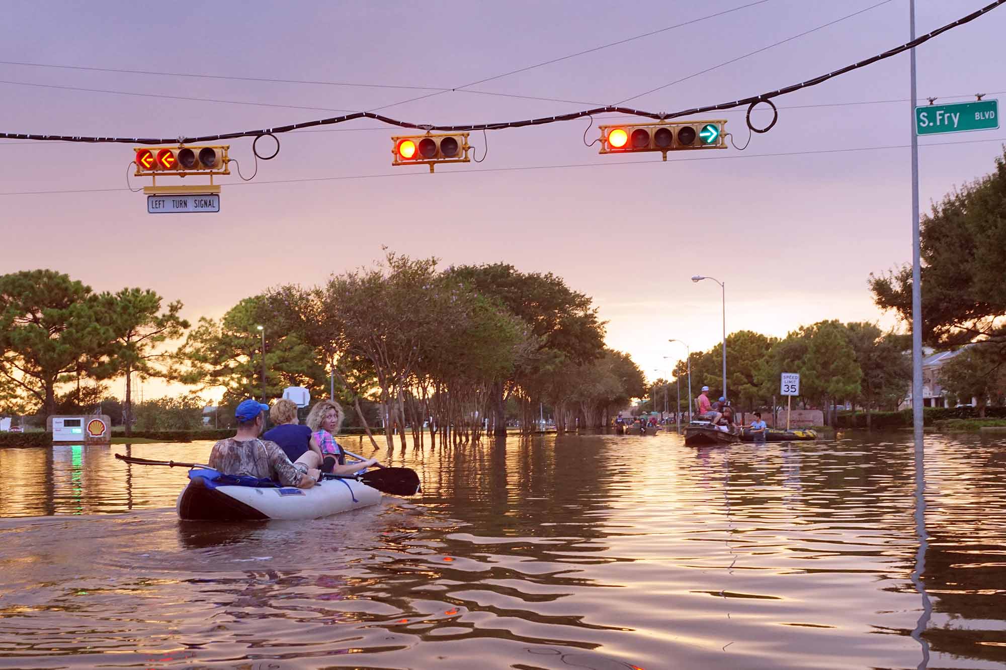
When a hurricane is approaching, it is crucial to follow the instructions in the hurricane local statement to ensure your safety. The hurricane local statement also provides information about how people should take action to prepare for the hurricane and stay safe during the storm. The message is updated as new information becomes available, and it is essential to stay tuned to local news and weather reports to stay up-to-date on the latest forecast.
PRECAUTIONARY/PREPAREDNESS ACTIONS
----------------------------------

* EVACUATIONS:

Listen to local official for recommended
preparedness actions, including possible evacuation. If ordered to
evacuate, do so immediately.

For those not under evacuation orders, assess the risk from wind,
falling trees, and flooding at your location. If you decide to move,
relocate to a safer location nearby. If you do not relocate, help
keep roadways open for those under evacuation orders.

If evacuating, leave with a destination in mind and allow extra time
to get there. Take your emergency supplies kit. Gas up your vehicle
ahead of time.

* OTHER PREPAREDNESS INFORMATION:

Now is the time to complete all preparations to protect life and
property in accordance with your emergency plan. Ensure you are in a
safe location before the onset of strong winds or possible flooding.

If you are relocating to safe shelter, leave as early as possible.
Allow extra time to reach your destination. Many roads and bridges
will be closed once strong winds arrive. Check the latest weather
forecast before departing and drive with caution.

If heading to a community shelter, become familiar with the shelter
rules before arrival, especially if you have special needs or have
pets. Take essential items with you from your Emergency Supplies Kit.

Failure to adequately shelter may result in serious injury or loss of
life. Always heed the advice of local officials and comply with any
orders that are issued. Remember, during the storm 9 1 1 Emergency
Services may not be able to immediately respond if conditions are
unsafe. This should be a big factor in your decision making.

Keep cell phones well charged. Cell phone chargers for automobiles
can be helpful, but be aware of your risk for deadly carbon monoxide
poisoning if your car is left idling in a garage or other poorly
ventilated area.

It is important to remain calm, informed, and focused during an
emergency. Be patient and helpful with those you encounter.

If you are a visitor, be sure to know the name of the city or town in
which you are staying and the name of the county or parish in which
it resides. Listen for these locations in local news updates. Pay
attention for instructions from local authorities.

Storm surge is the leading killer associated with tropical storms and
hurricanes! Make sure you are in a safe area away from the surge
zone. Even if you are not in a surge-prone area, you could find
yourself cutoff by flood waters during and after the storm. Heed
evacuation orders issued by the local authorities.

Rapidly rising flood waters are deadly. If you are in a flood-prone
area, consider moving to higher ground. Never drive through a flooded
roadway. Remember, turn around don't drown!

If a Tornado Warning is issued for your area, be ready to shelter
quickly, preferably away from windows and in an interior room not
prone to flooding. If driving, scan the roadside for quick shelter
options.

If in a place that is vulnerable to high wind, such as near large
trees, a manufactured home, upper floors of a high-rise building, or
on a boat, consider moving to a safer shelter before the onset of
strong winds or flooding.

Closely monitor weather.gov, NOAA Weather radio or local news outlets
for official storm information. Be ready to adapt to possible changes
to the forecast. Ensure you have multiple ways to receive weather
warnings.

* ADDITIONAL SOURCES OF INFORMATION:
- For information on appropriate preparations see ready.gov
- For information on creating an emergency plan see getagameplan.org
- For additional disaster preparedness information see redcross.org

NEXT UPDATE
-----------

The next local statement will be issued by the National Weather
Service in New Orleans LA around 4PM CDT, or sooner if conditions
warrant.

$$
A hurricane local statement is one of the longest text-based warnings that the National Weather Service issues. But it’s for a good reason: landfalling tropical systems pose a significant risk to both life and property. When you have the time during your preparations, it is good to read each one in full, as they provide all the information you’ll need to stay safe.
How to prepare for a hurricane
As the hurricane season approaches, it is vital to be prepared. Although meteorologists cannot predict the exact path of a hurricane, there are steps that you can take to ensure that you and your family are safe. First, make sure you have a supply of non-perishable food and water. These items should last for at least three days. In addition, have a first-aid kit on hand, flashlights, and extra batteries.
It is also good to have cash on hand, as power outages can disrupt ATM access. Finally, have an evacuation plan if you need to leave your home quickly. By taking these steps, you can help to ensure your safety in the event of a hurricane.
Hurricane safety tips
As the hurricane season approaches, it is vital to be prepared. Here are some tips that can help you stay safe during a hurricane:
- Evacuate if instructed to do so by authorities. If you are ordered to evacuate, do so immediately and follow the evacuation routes that have been established.
- Make sure your home is as hurricane-proof as possible. Secure doors and windows with shutters or plywood, and brace any sliding glass doors. Bring in any loose items from outside, such as lawn furniture or potted plants.
- If you are not ordered to evacuate, stay indoors in a room away from windows and doors. Turn off all utilities such as electricity, gas, and water.
- Have a hurricane plan and make sure everyone in your family knows what to do.
- Stay tuned to local news and weather reports for the latest updates on the hurricane. Hurricane local statements will also provide lots of helpful information.
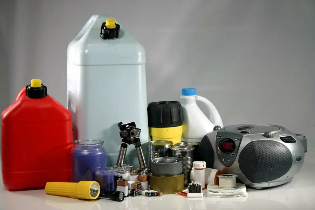
What should be in my hurricane emergency kit?
As any resident of hurricane-prone areas knows, it is vital to be prepared for the worst. A hurricane emergency kit should include everything you need to weather the storm, including food, water, first-aid supplies, and a flashlight. It is also essential to have a plan in place for what to do in case of evacuation.
If you live in an area vulnerable to flooding, make sure to have a supply of sandbags on hand. And finally, remember to stay informed. Keep a battery-operated radio in your kit, and tune in to local news stations for updates on the storm’s progress. By following these simple tips, you can be sure that you and your family will be safe and well-prepared.
Why you need to be prepared for hurricane season
Hurricane season officially begins on June 1st and runs through November 30th, with the peak period being from August to October. That means now is the time to start preparing. Here are three big reasons why it’s important to be prepared for hurricane season:
- Hurricanes can cause widespread damage and disruption;
- You may need to evacuate your home or take other action to protect yourself and your family; and
- Even if a hurricane doesn’t directly impact your area, you may still experience power outages, flooding, and other problems.
If you live in an area prone to tropical storms and hurricanes, it is important to have a hurricane emergency kit ready and know what to do in a storm.